


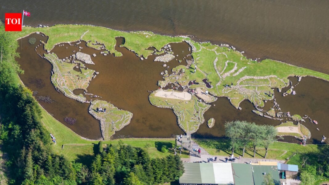
Long before satellite images and digital maps were commonplace, a Danish farmer carved one of the world’s most unusual geographical features into a lake entirely by hand. Inspired by a stone near Klejtrup Lake that resembled Denmark’s Jutland Peninsula, farmer Soren Poulsen spent about 25 years transforming the body of water into a giant miniature map of the world using rocks, soil, grass and clay. On the world map of Lake Kletrup in Denmark, visitors can walk on scaled-down continents separated by water representing oceans. Today, this handcrafted landmark remains one of Denmark’s most fascinating hidden attractions, still attracting thousands of visitors every year.
How a rock inspired an entire world map
The story begins in 1943, when Poulsen discovered a stone near Lake Kletrup that looked strikingly similar to the shape of Jutland, the large peninsula that makes up mainland Denmark. This discovery inspired him to try something extraordinary: reconstruct a map of the entire world within a nearby lake.Construction officially began in 1944. Using stone, earth, clay and vegetation, Poulsen slowly built miniature continents that rise above the lake like islands. The project lasted until 1969, a decades-long dedication.
Built from boulders dragged through winter ice
Historical accounts of the site indicate that some of the stones used in its construction weighed more than two tons. During Denmark’s harsh winters, Poulsen reportedly dragged many huge rocks across a frozen lake to more accurately locate the continent.The completed map measures approximately 45 x 90 meters and follows a geographical scale of approximately 27 centimeters per latitude. Antarctica was intentionally omitted, while some of the northern hemisphere proportions were adjusted to keep the flat representation visually balanced.
Walkable miniature earth
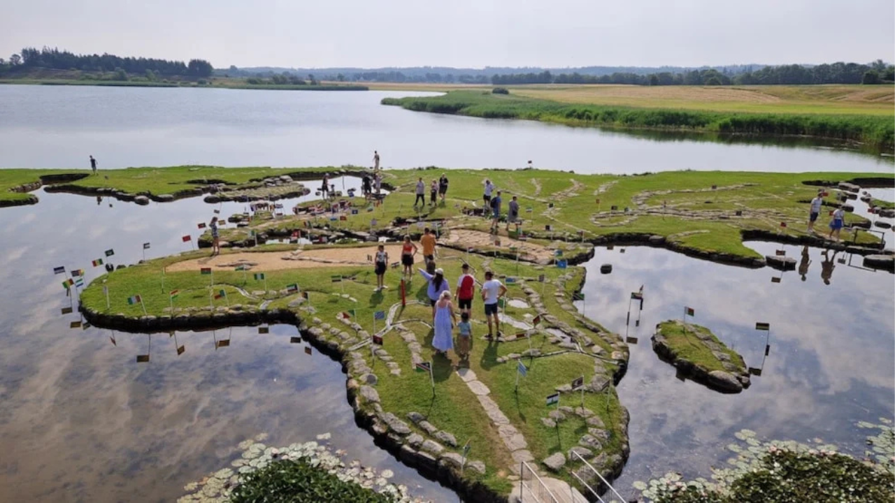
Unlike traditional paper maps, the attraction allows visitors to travel around the continent using paths, bridges and small viewing areas. Flags and markings identify different countries, while aerial photos reveal how similar this grassy landmass is to a smaller version of Earth.Over the years, additional decorative details were added to the site, including boundary markers and landscape features, believed to be inspired by Poulsen’s experience working in the United States before returning to Denmark.
Danish attractions still attract tourists today
Today, the World Map remains a Danish family-run tourist attraction and educational venue. Reports indicate that the landmark attracts approximately 40,000 visitors annually, especially during the summer months when visitors can fully explore the outdoor facilities.What began as a farmer’s fascination with oddly shaped rocks eventually turned into a giant handmade atlas floating in a lake, a project that still amazes visitors more than half a century later.


