


The highest chance of thunderstorms is in the Cascades Wednesday night. Drivers should expect the morning commute to be wet and potentially slick.
SEATTLE – Enjoy the warmth on Tuesday – the last of the 70s and 80s. Temperatures will fluctuate by nearly 20 degrees on Wednesday, with thunderstorms and widespread rainfall possible overnight.
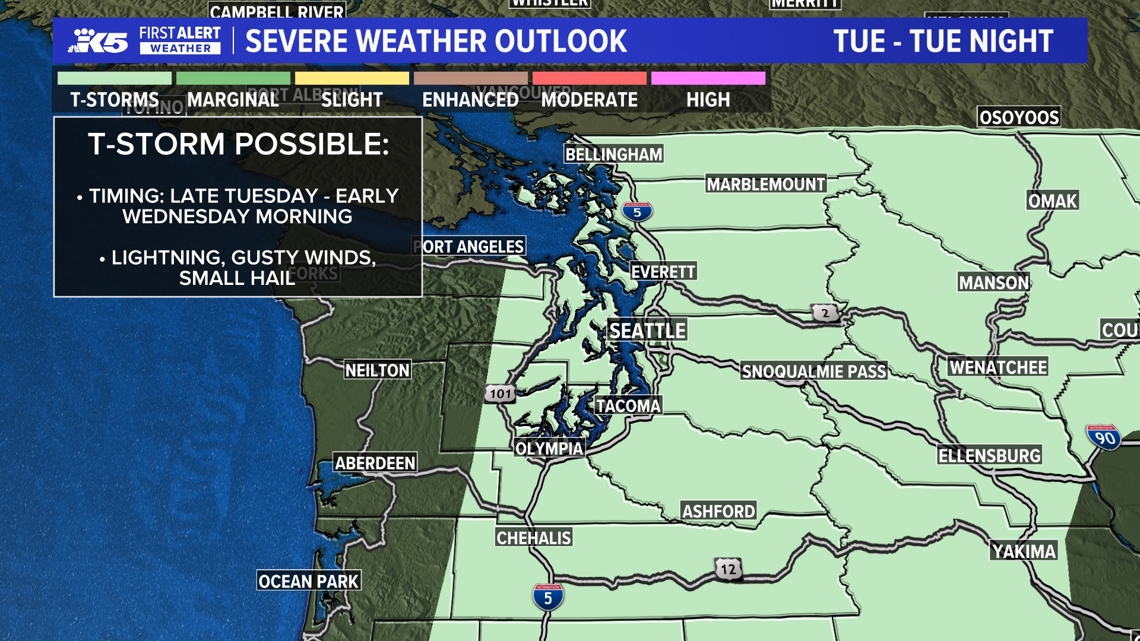
While the possibility of a pop-up storm this afternoon or evening cannot be ruled out, thunderstorms are likely Tuesday into Wednesday morning, especially in the Cascades, but no significant or widespread damage is expected.
Wednesday’s rain will end a nearly two-week drought that has seen temperatures in western Washington reach over 80 degrees. including some record-breaking highs.
Drivers should prepare for a wet and potentially slick morning commute.
Here’s information about the transition timeline weather:
tuesday afternoon
Tuesday afternoon, high pressure pushes eastward and the warmth disappears. The approaching low pressure overhead will bring rain and thunderstorms to the region, especially in the Cascades.
Overnight Tuesday to Wednesday
The main window of opportunity for thunderstorms in Western Washington will begin after 10 pm to around 6 am. Thunderstorm chances are highest in the Cascades and Foothills areas and east of the Cascades. However, thunder is also possible along the I-5 corridor and the Kitsap Peninsula.
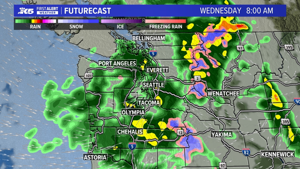
A narrow band of rain will move south to north from Oregon into western Washington late tonight into early Wednesday morning.
Wednesday
Rainfall early Wednesday could affect the morning commute and could leave roads slick from oil that accumulated during the dry period.
A second wave of rain will move from west to east across western Washington later in the morning.
Rain will taper off to showers by the afternoon, but winds will pick up from the southwest/west. Wind gusts of over 25 to 30 mph are possible at times and will weaken by Wednesday night. The strongest wind gusts are expected east of the Cascades, with wind speeds likely exceeding 40-50 mph.
Highs on Wednesday will only reach the upper 50s to lower 60s – a shocking change from today’s high temperatures!
total rainfall
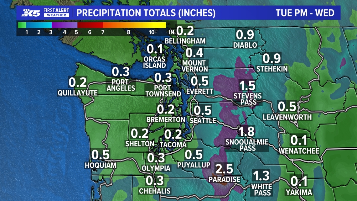
Through Wednesday, rainfall amounts of around 0.25 inch to 0.50 inch are expected in the lowlands and coast, and 0.50 inch to more than 1 inch in the Foothills and Cascades. If a convergence area develops over the North Bay and Central Bay, rainfall totals could be higher in some areas.
rest of week
This unsettled pattern will continue into the second half of the week, with a series of weak disturbances continuing from Thursday into Saturday, with showers expected and temperatures slightly cooler than normal in the upper 50s to lower 60s.
Showers are expected late Thursday into Friday, and also late Friday into Saturday.
High pressure is expected to gradually re-establish on Sunday, bringing milder and drier conditions to the region.

