


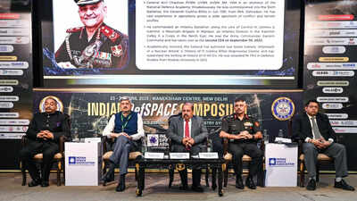
New Delhi: India’s Regional Navigation System Navik (Indian Constellation System Navigation), which cost over Rs 3,200 crore, is now in jeopardy as the number of fully functional navigation satellites in space has dropped to three. NavIC is designed to operate efficiently from a constellation of seven satellites, but accurate 3D Positioning, Navigation and Timing (PNT) services require at least four satellites.and Yisro In recent years, India’s regional system has faced failure due to the failure to launch two navigation satellites (IRNSS-1H in 2017 and NVS-02 in 2025) due to various reasons such as rocket failures. The number of satellites has dropped to three (IRNSS-1B, IRNSS-1L and the second-generation NVS-01), which is below the minimum requirement of 4 satellites. The major setback comes after the last atomic clock onboard the navigation satellite IRNSS-1F, the heart of the navigation satellite, stopped functioning on March 10, leaving only three satellites operational in the Indian NaVIC constellation.“NaVIC is remembered more for its failures and unfulfilled promises than anything else. It is time for a complete reimagining of NaVIC-type capabilities,” former Indian Air Force chief Rakesh Kumar Singh Bhadaria (retd), while speaking at the DefSpace Symposium on Thursday, said.Former Air Force Lieutenant General Dhananjay Khot, now the chief advisor for the ten-year vision and strategy implementation of space regulator IN-SPACe, also told TOI at the DefSpace seminar that NaVIC’s use of three satellites to operate is a major setback for security forces.The Indian armed forces use navigation satellite systems for logistics, mapping and operational planning. Even missiles navigate based on a country’s navigation system. Reliance on foreign navigation satellite systems can pose security problems, especially during times of war.At the height of the Kargil War with Pakistan, the United States refused to provide GPS data to India, which had planned to develop its own navigation system. With the launch of the first IRNSS satellite in 2013, India completed the constellation of seven satellites on April 28, 2016. However, with no replacement satellite launched, India’s navigation system needs urgent attention.In addition to the US GPS, Russia also operates GLONASS, Europe operates Galileo, and China operates the Beidou Navigation Satellite System (BDS). These three systems, like GPS, provide global coverage through a constellation of approximately 24-35 satellites in medium Earth orbit. China’s Beidou has more than 30 operational satellites, while Europe’s Galileo provides high-precision civilian positioning services around the world.


, costing upwards of over Rs 3,200 crore, is now hang.)